Pine to Superior. All the mountains.
This blog post was originally posted on The Trek right here.
Stats:
Miles: 338.6- 495.3
Days: 15- 22
The Mazatzal Mountains.
“Mazzies will kick your ass,” tell us ladies, heading northbound, about the upcoming Mazatzal mountain range. I don’t even doubt them — all uphills kick my ass.
On the first day, we hike 22.1 miles, the last six of which are just uphill. Eventually I break and put on some music. I usually prefer to hike mostly in silence, occasionally listening to an audiobook, but when I need to turn my thoughts away from the suffering of an uphill climb, this is when I need music.
I listen to the soundtrack of one of my favorite movies, The Hunt for the Wilderpeople by Taika Waititi. If you’ve never seen it, do — it’s fantastic. There’s this song, “Skux Life,” with lyrics that go:
“Majestical
And we are the wilderpeople.
Skux life.
Majestical.
And we’ll be on the run forever.
Skux life.”
I imagine a drone shot zooming out on me, further and further, until I am a tiny dot and everything around me is just green hills. Nothing but green. My petty uphill problems, zoomed out, shrink to a dot as well. I feel better. The song helps.
The peaks are now below us, shadowed from the orange sun above them, deep dark green and blue. They stretch further and further, until they vanish in the mist, draped as a sheer white blanket over the horizon, only the very tips poking out of it.
They say your eye can see about 100 miles, even standing on a mountain. I’m going to walk that far — further than these blue-green mountains, further than the mist and the peaks sticking out of it. Every time I stand on a mountain and look into the distance, it amazes me. I never thought I could walk this far. Yet every time, I walk even further.
Lightning again?
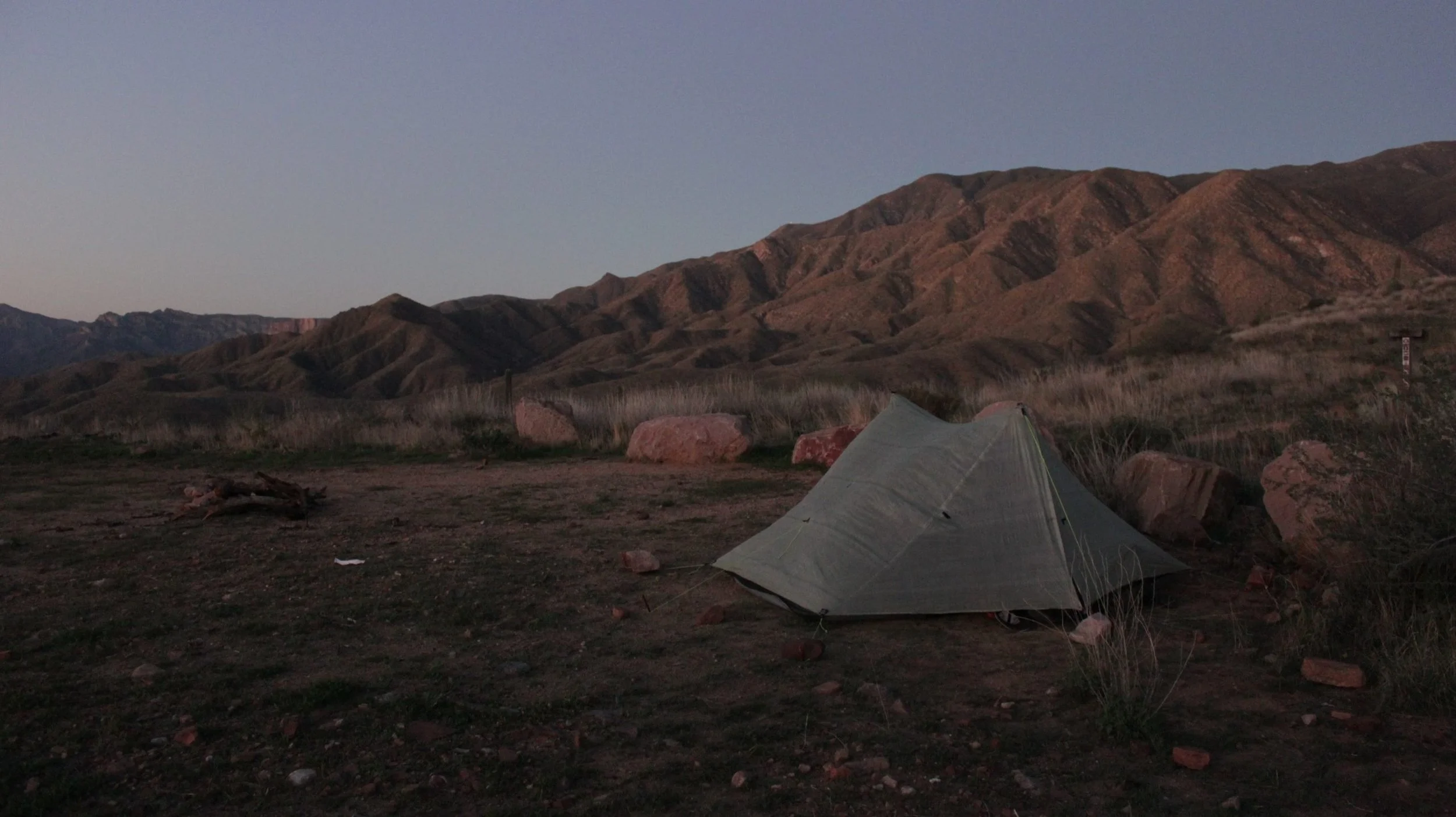
We pitch our tent on a saddle, right below the top of the climb, and sleep with the setting sun. We are awoken by flashes at 04:30. I stick my head out. Lightning flickers here and there — it’s hard to tell exactly where. No thunder. Our alarm is set an hour from now, but we won’t fall asleep anyway, so we walk. It’s dark but warm. Tiny white moths flutter around my headlamp, and I move like a sleepy ghost of a moth-whisperer among the dark, hunched mountains, distant lightning flashing in the night sky.
It starts to rain, reminding my drowsy self that I’m actually thirsty. The scratch marks on my legs begin to sting a little when wet.
Soon it lightens, and we reach the highway, where Trail Angel Scott picks us up and takes us to Tonto Basin, where Scott and Becky have this paradise of a garden, little rabbits jumping around, birds and lizards visiting, pomegranates thriving and splitting.
So many churches!
We walk to do our food resupply and leave Kez’s phone charging. It’s easy to find a place — right behind the church. Well… it gets dark. We find a church, go right, then left. It doesn’t look like what it’s supposed to. We track back. It still feels like we’ve never been there. But it’s right behind the church, how come we can’t find it?! Eventually, I call Becky using my international phone number to ask for the address. Turns out we went behind the wrong church. The right one is a bit further down. Scott goes out to the street near the correct church with a hand torch to meet us. I don’t think I’ve ever felt more lost among the many houses of God.
The Four Peaks
Four Peaks kicks your ass no less than the Mazatzals. It’s up and down, overgrown with brambles, and badly washed out from recent rains. A couple of miles in, I get rattled — as always — without warning, right when I’m near the snake warming itself in a bush. A bit later, I spot a bald eagle.
This is what got me my trail name on the PCT. Pine Nut. Nuts about those pines.
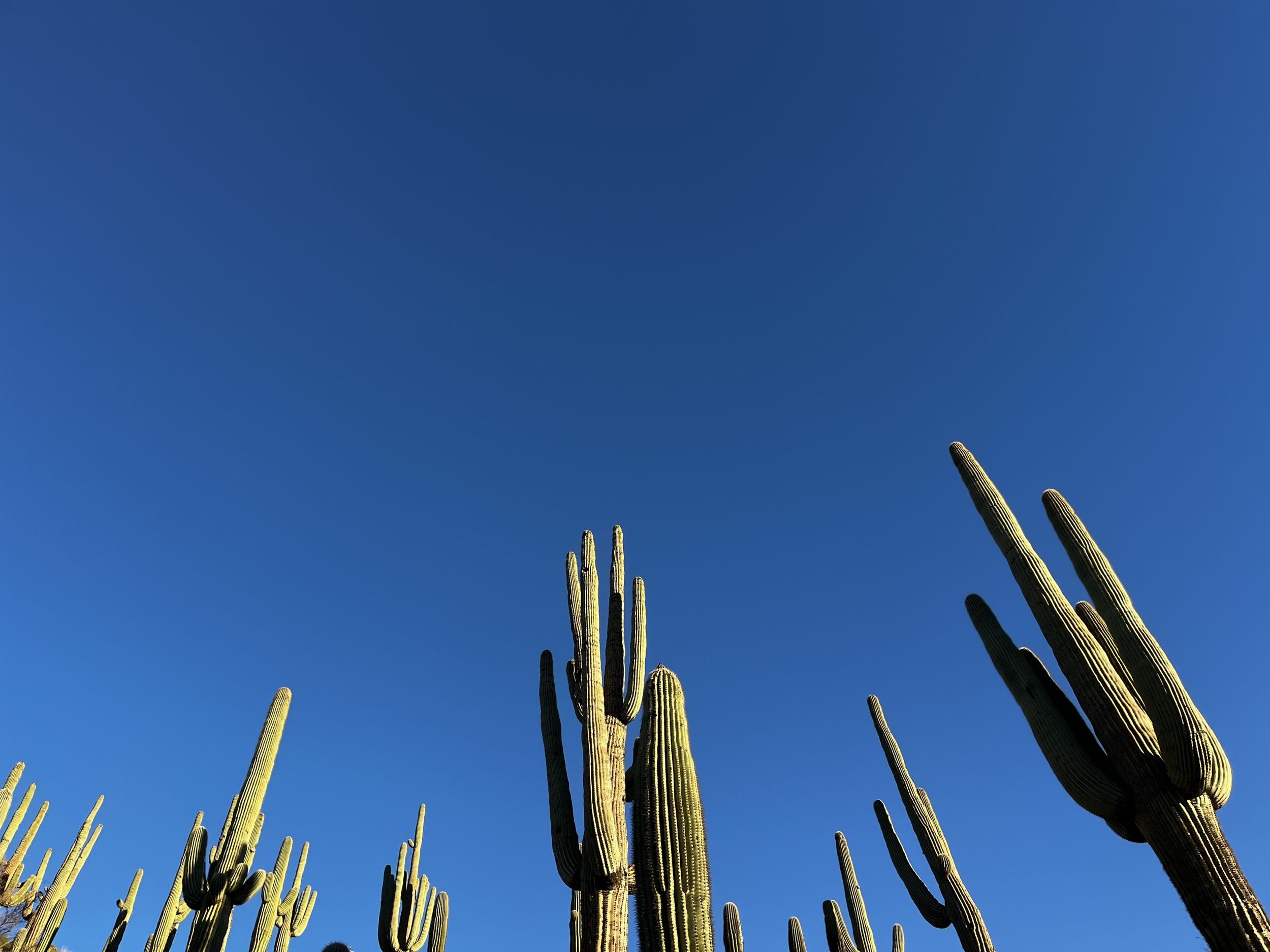
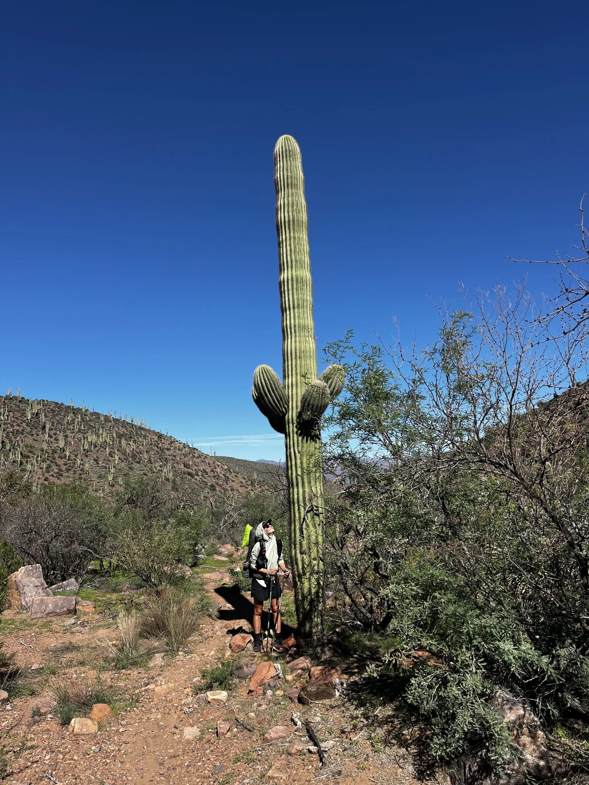
Tonto Basin marks roughly the edge of the Sonoran Desert for AZT hikers. This is where elevation starts decreasing, ponderosa pines are no longer present and saguaro cacti begin appearing. At sunrise, we walk through entire forests of these limbed giants. I’ve never been close to one before, and suddenly I am surrounded by tall, prickly figures.
Hunting season has started, so we meet more and more hunters. “Have you seen any deer today?” is the common question. “No,” is the common answer. We rarely see more than one or two. “You?” “Just a couple. There are more people than deer.” He’s right — we’ve definitely seen more hunters speeding in their small UTVs, raising dust and most likely alarming the animal world.
Superstitions
Roosevelt
After ice cream and coffee in Roosevelt, the town where a dam was built in 1911 (and where former President Theodore Roosevelt came to dedicate it), we climb the Superstition Mountains. The name carries many legends. The Western Apache called the mountains “The House of the Thunder God”and believed the peaks housed powerful spirits.
In the late 1800s, Jacob Waltz, a German immigrant called “The Dutchman,” allegedly found a gold mine in the area. He kept the location secret, and it has never been found. Apparently, quite a few people have gone missing or died mysteriously in these hills, either searching for gold or simply traversing the mountains of the Thunder God.
Trail Heroes
We go up in peace, undisturbed. Recent storms have washed out much of the trail. Cottonwood Canyon looks like a giant river tore through it, ripping up trees, boulders, and walls. We meet two crews working to restore the trail — one from the Forest Service, one volunteer. Thanks to them, the trail is much easier to follow: they clear debris, build stairs, and put up cairns. Between the crews, the trail is unmaintained, and the difference is stark. If you didn’t know to walk in the creek bed, you’d get lost among rocks and broken branches.
We climb and climb, and the sun sets, painting the peaks orange and pink. Tomorrow is town day. It wasn’t supposed to be, but somehow we routinely walk 22 miles instead of 20, so our plan to camp seven miles before town becomes: “Why not walk 25 miles tomorrow and have a full day off in town the next day?” Well, why say no to that?

It’s hot. Twenty-five miles are very doable in spring or summer, but in fall, when days are short, you have to finish by 6 PM. That’s a tight deadline. To quote a character from The Office: “Somehow I manage.” We reach Superior by 6 PM. Trail Angel MJ picks us up and drives us past the Apache Leap cliffs, sharing its legend. Tomorrow we rest.
Things I learned along the trail.
I decided to add this bit at the end of my blog posts because I like learning about the places I walk through. I’m not local, so if you notice that I’ve misunderstood or missed something, please feel free to point it out in the comments.
1. Can you know the age of Saguaro by looking at it? Roughly. They generally don’t grow limbs until 50–70 years old. Scientists also use the ribs and horizontal growth bands, though these are less reliable than tree rings. Saguaros can live up to 200 years and are protected by federal law — you cannot cut, move, or damage them without risking fines or jail time.
2. Apache Leap legend. The legend says that in the 1870s, during conflicts with the U.S. Army, a group of Western Apache warriors was chased to the cliffs of Apache Leap. With the army cutting off their escape and a steep drop on the other side, the Apache chose to leap from the cliffs rather than surrender.
3. Word “Tonto” comes from the Spanish word meaning “crazy” or “wild,” likely applied to local Apache groups.
4. Word “Apache” comes from the Zuni (a Native American tribe from western New Mexico) word “apachu”, meaning “enemy” or “stranger.” The Spanish adopted it as “Apache,” and English speakers followed suit. Apache groups did not initially call themselves that — they were Diné, Dilzhé’e, and Ndé — but today most officially use “Apache” in their tribal names.